San Pedro Creek Watershed as seen from San Pedro Headlands looking EAST towards Sweeney Ridge.

San Pedro Creek Watershed as seen from Cattle Hill looking South towards the San Pedro Headlands.
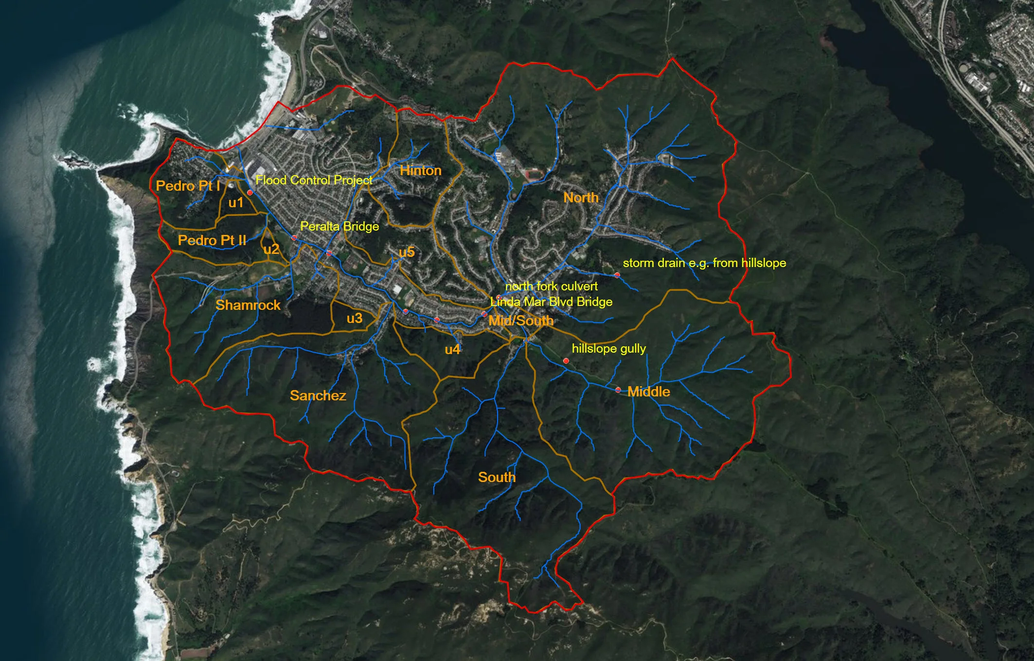
GEOGRAPHY
Located less than 10 miles south of San Francisco City Limits, the San Pedro Creek runs through the Linda Mar neighborhood of the City of Pacifica. The headwaters are in the southeastern reached of the valley meeting up to form the main stem that runs northwest into the Pacific Ocean.
THE NORTHERN boundary of the watershed is a slight ridge that separates Linda Mar nighborhood from the Rockaway neighborhood of the Caldera Creek Watershed.
THE SOUTHERN boundary is the ridge formed by Montara Mountain, San Pedro Mountain and the Pedro Point Headlands.
THE EASTERN boundary is Sweeny Ridge, with the San Andreas fault and with the town of Milbrae beyond.
TO THE WEST, the mighty Pacific Ocean